天文GPS水准方法的研究
来源期刊:中南大学学报(自然科学版)2004年第4期
论文作者:许曦 刘庆元 朱建军
文章页码:681 - 685
关键词:跨障碍高程传递;天文GPS水准;垂线偏差;高程
Key words:height transfer across obstacle; GPS astronomical leveling; vertical deflection; height
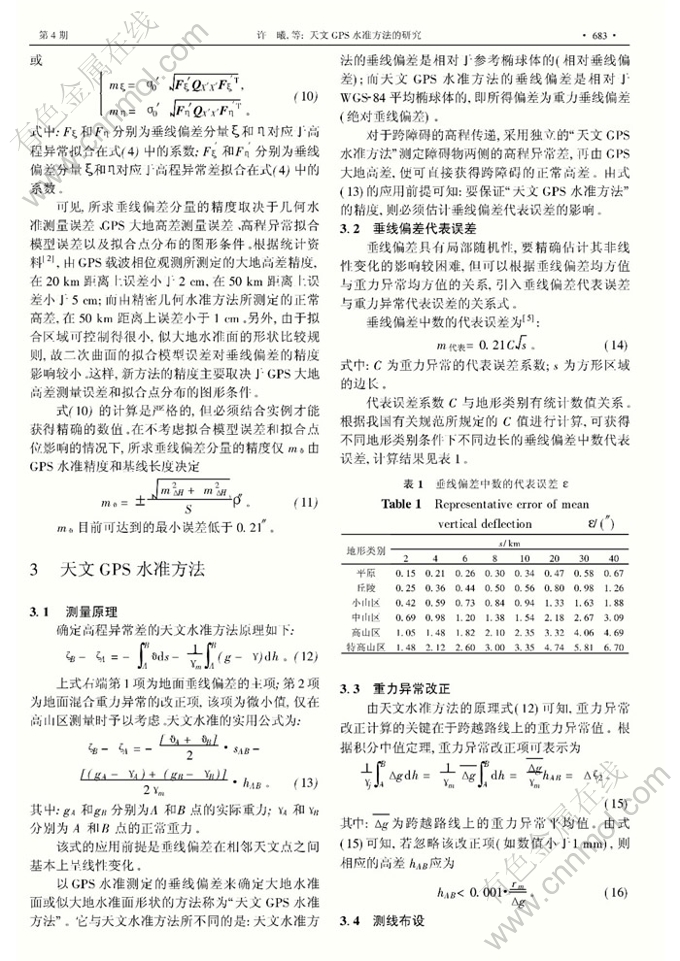
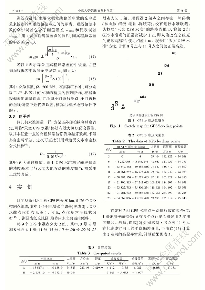
摘 要:鉴于障碍物两侧的高程基准不一致,采用常规的GPS水准数值拟合方法,无法实现跨障碍高程传递,提出了一种天文GPS水准方法,即采用常规GPS水准方法分别拟合障碍物两侧的似大地水准面形状,分别求得相对于WGS-84的地面垂线偏差;由于两侧所求垂线偏差属于同一系统,因此,可根据天文水准原理,进一步计算出跨障碍的高程异常差;再由GPS所测大地高差,可获得跨障碍的正常高差。应用该方法对辽宁阜新引水工程GPS网进行试验,在9.6 km的跨越距离上,试验结果与独立的三等几何水准结果比较,差值为12 mm。研究结果表明:天文 GPS水准方法是一种远距离、高精度跨障碍高程传递方法。
Abstract: Since the general geometrical fitting method of GPS level cannot be used directly for height transfer across obstacle when the height datum planes of both sides of obstacle are not consistent, a new method named GPS astronomical leveling is proposed based on astronomical leveling .First ,GPS leveling is used to fit local quasi geoid of both sides of obstacle and then vertical deflections are determined, which belong to WGS-84.Second,because they belong to the same system,the principle of as tronomical leveling can be adopted to calculate the height anomaly difference across obstacle .At last , normal height difference across obstacle can be determined through ellipsoidal height difference by GPS . Based on the above method , GPS network of the Liaoning Fuxin Channeling Water Project was tested. At a distance of 9.6 km, the transferred normal height difference by this method is 12 mm,compared with that by independentⅢgrade leveling. The results show that GPS astronomical leveling is an effective method for height transfer across obstacle at a long distance with high precision.